
![Image shared for The Old Man of Coniston [Coniston Old Man]](/media/gallery/480/0c140e91269b49abbee339fc41828d25.jpg)
The Old Man of Coniston [Coniston Old Man]
Good walks are even better shared.
Overview
The Old Man of Coniston rises above Coniston village in the southern Lake District. Its 802.4 m summit, Low Water and Goat’s Water link mountain scenery with the remains of slate quarrying and nearby copper mining. Routes range from steep out-and-back ascents to longer circuits over neighbouring fells; all need mountain-walking preparation and navigation.
The Old Man of Coniston
The Old Man rises above Coniston village in the southern Lake District, with steep corries, tarns and industrial remains packed into its approaches. 802.4 m is the current DoBIH height. The substantial summit cairn and nearby trig point are useful landmarks, but the measurement refers to exposed rock beside the stone plinth; the source warns that higher ground may be hidden beneath it. DoBIH summit record
Choosing an ascent
The Low Water route climbs through disused slate workings and finishes with steep zigzags. The alternative through The Cove and Goat’s Water reaches Goat’s Hawse before climbing to the Old Man. A circular walk can use these two approaches, with the Crowberry Haws path linking the Low Water side back to Walna Scar car park. Starting in Coniston adds the village approach and return. Cumbria Tourism route guide
Longer variants can include Dow Crag and Brim Fell. Dow Crag is reached by its walking ridge, not its climbing cliffs; an out-and-back from Goat’s Hawse avoids implying a path straight up the face above the tarn. Torver starts need a planned return via Walna Scar and the outward path, or separately arranged transport if finishing in Coniston. The five route outlines below identify their returns. Local route options
These are mountain-walking outlines rather than turn-by-turn navigation. Choose a route for the whole party and the conditions, carry a suitable map and compass, and leave time for the descent.
Rock and working landscape
BGS identifies volcanic lapilli-tuff of the Lag Bank Formation on the mountain. Slate here reflects later cleavage of volcanic and sedimentary rocks. British Geological Survey memoir
The slate quarries on the ascent and the copper workings in the neighbouring valley are different industries. Copper extraction at Coniston was developed by the Company of Mines Royal around 1590 and expanded in later centuries. The surviving structures and spoil deserve care. National Park mining history
Hazards and preparation
Stay on established paths and keep away from quarry edges, shafts and mine entrances. Underground workings can contain unstable spoil and deceptive floors; the National Park advises walkers not to enter them. National Park safety and heritage guidance
Low cloud can hide the correct summit descent, and wet rock, strong winds or winter ice can greatly increase the difficulty. Do not improvise shortcuts down a crag or quarry face. Check a mountain forecast, carry waterproofs, warm layers, food, water and a headtorch, and be ready to turn back. In an emergency call 999 or 112, ask for Police, then Mountain Rescue. Mountain Rescue advice
Access and views
Walna Scar car park gives a higher start, but its access is a steep single-track road and charges apply. Coniston village is the alternative starting point, with cafés, shops, pubs and public toilets at Ruskin Avenue. Walna Scar parking · Ruskin Avenue parking and toilets
The 505 serves Coniston via Ambleside and Hawkshead. Check the date-specific timetable and return connections before committing to a long circuit. Stagecoach 505
In clear conditions, the outlook includes Coniston Water, neighbouring fells and the coast. No season guarantees visibility. The origin of “Old Man” is also uncertain: “high stone” is a traditional proposed derivation, not a securely established translation. Historical discussion of the name
Sources and review
Source checks completed on 15 October 2026 (UTC). Summit data: Database of British and Irish Hills v18.6, released 11 September 2026, record 2634 revised 23 October 2023. That record revision is retained separately from this editorial review date; it is not asserted to be the survey date. DoBIH downloads
Explore routes near The Old Man of Coniston [Coniston Old Man]
Walks starting near this hill. Open a route to check its map, distance and full itinerary.
Coniston to Tarn Hows: Monk Coniston Gardens and Woodland Circuit
View route
Great Carrs Halifax Wreckage from Wrynose Pass
View route
Tarn Hows Fast Route
View route
Bow Fell from Langdale
View route
Route planning notes
These notes describe possible approaches. Check a route's map and access information when planning your walk.
Walna Scar Road and Goat’s Water Circuit
Start and finish at Walna Scar car park. Follow Walna Scar Road to the Goat’s Water path, continue through The Cove and beside the tarn to Goat’s Hawse, then climb east towards the Old Man. Descend by the Low Water zigzags and quarry path to Crowberry Haws; take the southbound track back to Walna Scar car park. Keep out of quarry workings and allow for steep, rocky ground.
Low Water Direct Ascent
Start in Coniston village. Use the Coppermines Lane approach and the Miners Bridge / Crowberry Haws connection to the established quarry path. Climb past Low Water and follow the steep summit zigzags. Return by the same route to Coniston. This is a substantial mountain ascent from the village; the shorter walk from Walna Scar car park is a different start.
Coniston Fells Ridge Walk
From Walna Scar car park, approach Goat’s Hawse via The Cove and Goat’s Water. Visit Dow Crag by its north ridge and retrace to the hause; do not attempt its east-facing cliffs. Climb back to the main ridge, take the out-and-back extension north to Brim Fell, then head south to the Old Man. Descend via Low Water, the quarry path and Crowberry Haws to Walna Scar car park. The Dow Crag top is rocky and this variant adds ascent and navigation.
Torver Circuit via Goat’s Water
From Torver, take the Scarr Head and Banishead approach to Walna Scar Road, then the path through The Cove to Goat’s Water and Goat’s Hawse. Climb to the Old Man and descend via Low Water and the quarry path to Crowberry Haws, then south to Walna Scar car park. Follow Walna Scar Road west to rejoin the outward Torver path and retrace it via Banishead and Scarr Head. Allow for this full return leg; descending into Coniston does not complete the circuit to Torver.
Coppermines Valley and The Old Man
Start and finish in Coniston village. Follow Coppermines Lane, cross at Miners Bridge and take the Crowberry Haws / quarry path to Low Water and the summit zigzags. For the circuit, leave the summit towards the main ridge, take the Goat’s Hawse descent and continue past Goat’s Water to Walna Scar Road. Follow it east to the fell gate, then descend the metalled lane to Coniston. Avoid mine openings and quarry edges throughout.
Make a day of it, together
Find someone to share the walk with, or organise a day out along a route you like.
Photo Gallery
View all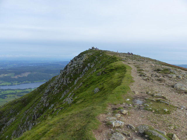 Photo could not load
SD2797 : The Old Man of Coniston
Anthony Foster
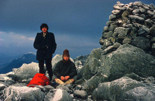 Photo could not load
SD2797 : Frosted summit cairn, Old Man of Coniston
Julian Paren
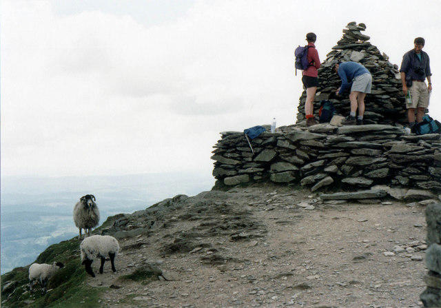 Photo could not load
SD2797 : Sheep on the Old Man of Coniston summit
jirikruta
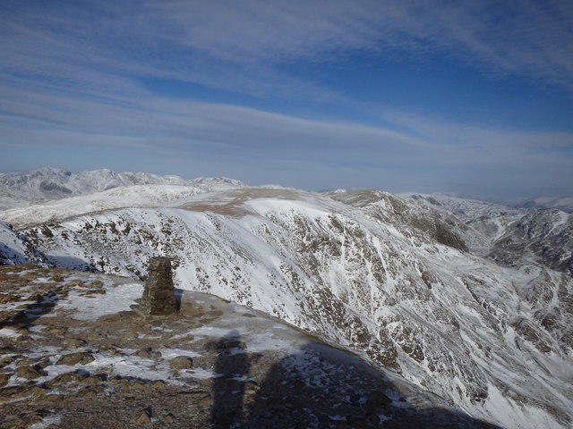 Photo could not load
SD2797 : On Coniston Old Man
Michael Graham
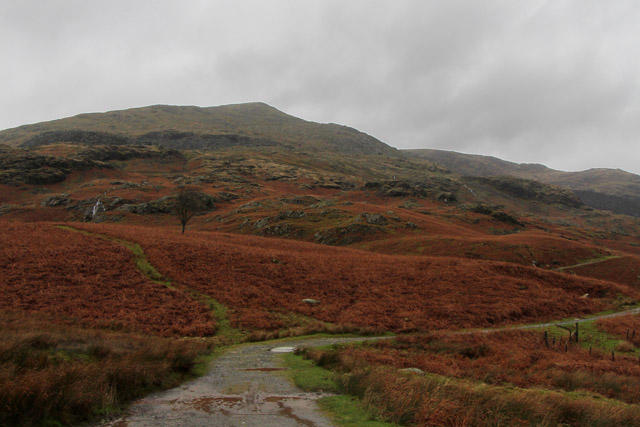 Photo could not load
SD2797 : The Old Man of Coniston
Kate Jewell
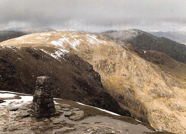 Photo could not load
SD2797 : The summit of The Old Man Of Coniston
Tim Glover
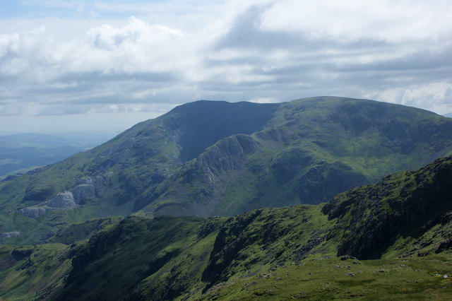 Photo could not load
SD2797 : The Old Man of Coniston
Ian Greig
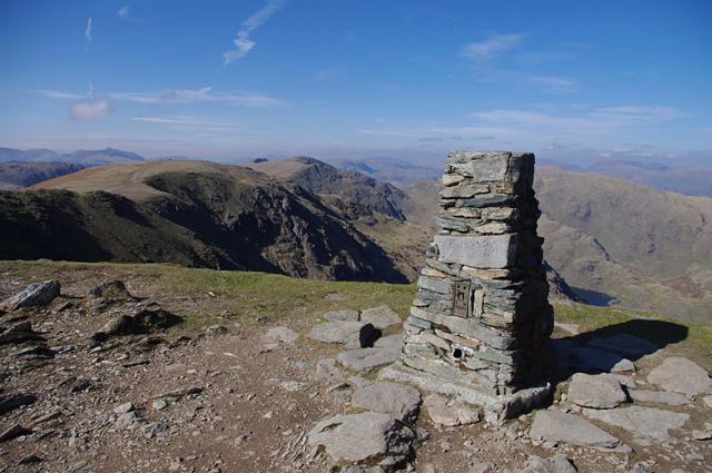 Photo could not load
SD2797 : Trig point, the Old Man of Coniston
Ian Taylor
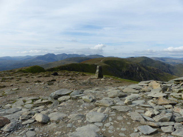 Photo could not load
SD2797 : Triangulation Pillar, The Old Man of Coniston
Anthony Foster
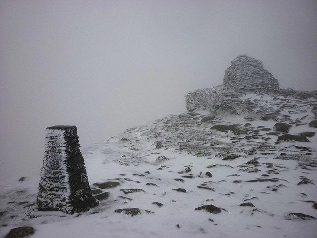
SD2797 : A monochrome Old Man of Coniston
Karl and Ali
Hill facts and local notes
Classifications
Elevation
802m
2,633 ft
Prominence
417m
Coordinates
54.3707, -3.1215
SD272978
OS Map
96 97
Explorer: OL6N
At the Summit
A substantial cairn and stone plinth stand near a trig point. DoBIH locates the summit at the cairn 12 m southeast of the trig point, but its 802.4 m measurement is for exposed rock beside the extensive plinth; the source notes that higher natural ground may be concealed underneath it.
Terrain & Geology
The Old Man lies in the Borrowdale Volcanic Group. British Geological Survey identifies thick dacitic lapilli-tuff of the Lag Bank Formation on the mountain: rock deposited by ancient explosive volcanic activity. The district’s slate reflects later cleavage in volcanic and sedimentary rocks. Its quarry scars and the corries of Low Water and Goat’s Water are distinct parts of the landscape.
Views & Scenery
Coniston Water and the village below, the nearby Coniston Fells and Dow Crag, with longer views towards the central Lakeland mountains and the coast when visibility allows.
Best Seasons
Snow can transform the high corries and ridges in winter, while the tarns and quarry remains give the routes interest throughout the year. Clear views depend on the day’s weather, not a guaranteed best season.
History & Heritage
Name Origin
The origin of ‘Old Man’ is uncertain. A proposed Celtic alt maen, usually rendered ‘high stone’ or ‘high rock’, is a traditional explanation, but should be treated as a suggestion rather than a settled derivation.
Historical Significance
Slate quarrying left conspicuous workings on the mountain, while the neighbouring Coppermines Valley records a separate copper-mining industry. The Company of Mines Royal began work at Coniston around 1590; later expansion brought extensive workings and water-powered machinery. The surviving paths, structures and spoil are industrial heritage as well as hazards. The fell is also the historic county top of Lancashire in DoBIH.
Getting There & Facilities
Parking
Walna Scar car park at the fell gate is a higher starting point, reached by a steep single-track road from Coniston; parking charges apply. Ruskin Avenue car park in Coniston provides a village start with extra ascent. Check signs and current restrictions, leave access clear and have a village alternative if the higher car park is full or the access road is unsuitable.
Public Transport
Stagecoach 505 serves Coniston via Ambleside and Hawkshead. Check the operator’s timetable for your travel date, connections from Windermere and the last return bus. The bus stop is in the village; walking to the Walna Scar fell gate adds ascent and time.
Nearby Facilities
Coniston has cafés, shops and pubs; public toilets are listed at Ruskin Avenue car park. Plan refreshments and toilet stops in the village, and carry food, water and mountain equipment for the ascent.
Safety Information
Known Hazards
- Steep, uneven paths and loose or wet rock around Low Water, Goat’s Water and the upper slopes.
- Old slate quarries and copper workings contain shafts, unstable spoil, steep drops and unsafe underground floors. Keep to established paths, stay clear of edges and do not enter mine openings.
- Low cloud can obscure summit junctions and the correct descent. Do not shortcut down crags or quarry faces.
- Strong wind and cold affect the exposed summit and ridges; longer extensions add exposure and navigation demands.
Seasonal Hazards
Snow and ice can turn steep paths into serious winter terrain and hide route junctions. Short winter days reduce the margin for a long circuit. In wet weather, rock and slate can be slippery; in hot weather, carry sufficient water. Check a mountain forecast and conditions before setting out, and turn back if they exceed your skills or equipment.
General Safety Tips
- Check weather conditions before setting out
- Carry appropriate clothing and equipment
- Let someone know your planned route
- Take a map, compass, and GPS device
- Carry emergency supplies: food, water, first aid kit, torch
Hills
Some common questions about the hills answered
Are there group walks up The Old Man of Coniston [Coniston Old Man]?
Many walkers use Walkmates to join or organise walks with others. You can check for group walks around The Old Man of Coniston [Coniston Old Man] through the maps
Are there other walkers around The Old Man of Coniston [Coniston Old Man]?
Activity varies by location and time, but Walkmates lets you see whether others have shared walks or shown interest in this area. Find other people through the walking friends search walking friends for The Old Man of Coniston [Coniston Old Man] search or of course create your own walk for The Old Man of Coniston [Coniston Old Man]
Can I organise a walk to The Old Man of Coniston [Coniston Old Man]?
Yes. If there aren’t any walks listed already, you can create a walk and make it available for others to join.
If you're signed up to Walkmates, you can create a walk to The Old Man of Coniston [Coniston Old Man].
How do I find a walk up this hill?
There are often multiple ways to walk this hill, depending on experience and route preference. Walkmates helps you explore walks and routes that others have shared.
Can I suggest a new route up The Old Man of Coniston [Coniston Old Man]?
Yes. You can suggest or create routes to share with others. Walkmates focuses on the social side of walking, so routes are used to help people organise walks and explore areas together, rather than as detailed navigation tools or route libraries.
Other uses really appreciate knowledgeable walkers sharing their routes. Share your favourite route to The Old Man of Coniston [Coniston Old Man] here
The is an error or something incorrect about this hill. How do I let you know?
We always strive to keep the information on Walkmates as accurate as possible. If you find an error, please let us know through the contact form and we'll aim to correct it as quickly as possible
Community Discussion
Comments
Location
![The Old Man of Coniston [Coniston Old Man] location map](https://cdn.walkmates.com/hill-maps/hill-sources/2634/54.37066_-3.12145.png)
Grid reference: SD272978
View on OpenStreetMapOpens a map in a new tab, centred on the hill.
Nearby Hills
Dow Crag
778m
Wetherlam
763m
Pike of Blisco
703m
Crinkle Crags - Long Top [Second Crinkle]
859m
Hard Knott
550m
No comments yet. Be the first.